
Useful AI Tools - Satellite Analysis with AI
Detect objects in satellite imagery using simple text prompts. Export GeoJSON and CSV data for GIS workflows. Free demo available for enterprises.

Published on Mar 31, 2026
Visit site
3 upvotes
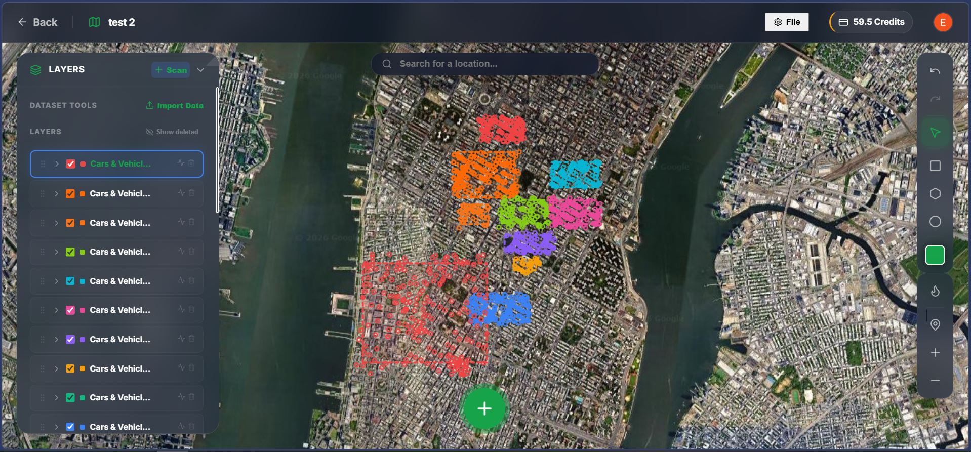
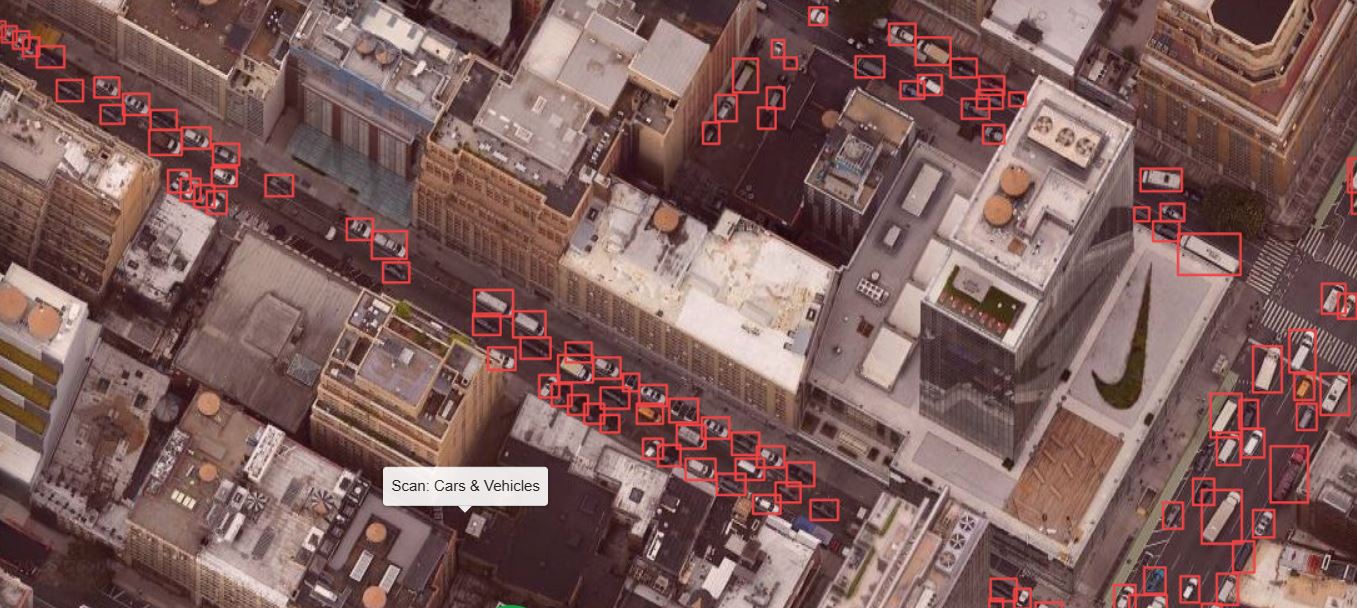
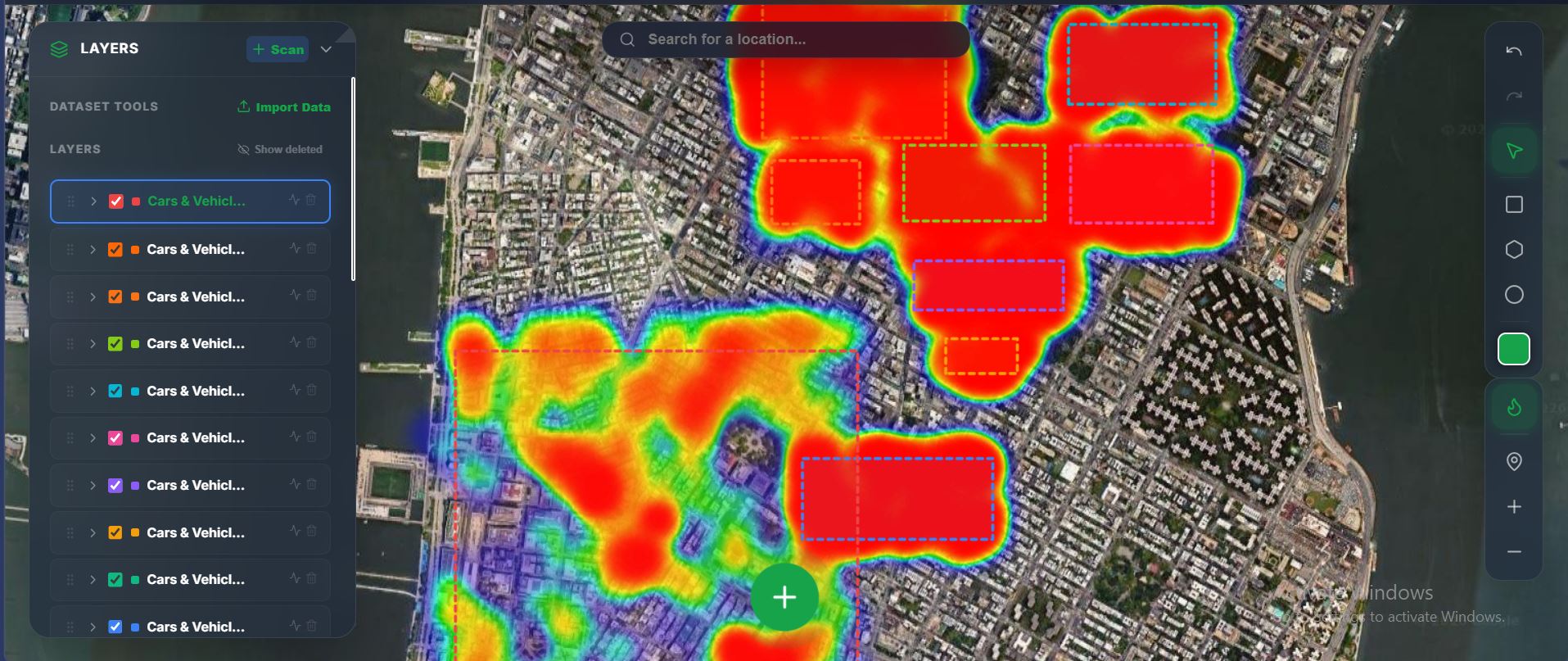
Useful AI Tools lets you detect any object in satellite imagery just by typing what you're looking for. No model training, no GIS expertise needed. Draw an area on any map. Type a prompt like "swimming pools," "oil tanks," or "solar panels." The AI scans every tile and projects bounding boxes directly onto the globe. - Zero-shot detection (no custom training) - GeoJSON & CSV exports for QGIS/ArcGIS - Density heatmaps & spatial analytics - Free demo no login required
Screenshots (4)

Comments (0)
No comments yet. Be the first!